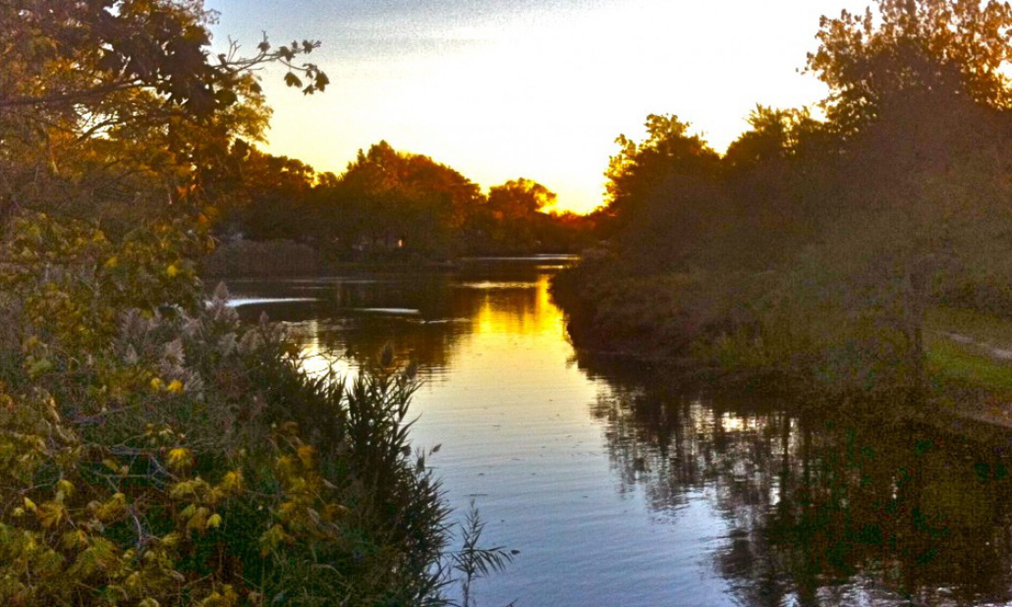
If you decided, for some strange and indefensible reason, to drive from the bottom to the top of New York State in a straight south to north direction, starting at Kennedy Airport and ending at the Canadian Border, at two points in the first half of your pointless journey, you would be just a couple of miles from my house. I can’t say for sure whether I’d be home. Or home. But if I am, please stop by. We don’t get many visitors these days.
Call first.
And if you chose to take the scenic route on this silly excursion (and you may as well), you would also get to know New York State Route 22, which runs 337.26 miles from the Bronx almost to Quebec, and parallels the borders of Connecticut, Massachusetts and Vermont. One stretch of this mostly two-lane road runs about 60 miles, from Brewster to Copake Falls.
That stretch is mine.
Between myself and Trisha, plus one run from a friend with a van (who stopped at Brewster Pastry to buy us a Danish that couldn’t be beat) we did twenty round trips from Valley Stream to Copake Falls in the first six months of owning a second house, logging around 4,000 miles, back and forth, back and forth, hauling, among other things, three air mattress, a four-seat dining room set, a complete set of curtains with bear and deer silhouettes, a 12-Cup Mr. Coffee, eight lamps, six framed pictures, four patio chairs and a matching table, a set of silverware, plates and bowls, a portable firepit, two window fans, a space heater, a TV and the stand to put it on, a microwave oven, two air conditioners, a dresser, two nightstands, five end tables, a set of fireplace tools, two rugs, a shower curtain, a shower head, two strings of party lights, a desk and chair set, seven folding chairs, two toilets, a combination pool table/ ping pong table, a convertible couch, a copper rooster wind vane, a dog crate with two dog beds and a new kitchen sink, so don’t even bother saying it, ‘cause we did.

I knew those miles of Route 22 pretty well before. Now, either way I’m traveling, north or south, it’s the street that goes to my house. So while the other chapters in this book will either be somewhere around my house or somewhere around my other house, in this chapter, I’m going to take you on a ride, and hopefully show you what makes this stretch of road so interesting and so unique. But you have to promise to want to learn things that you really don’t have to know. And I have to hit you over the head with two-thousand words of backstory first.
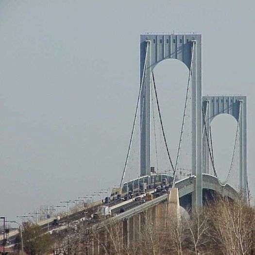
Now, as anyone who has traveled north to south from Upstate into New York City and Long Island knows, the experience is kind of like sitting home watching this nice show about farms and trees on TV and BANG! Suddenly a bunch of stormtroopers break in and grab you, throw you behind the wheel of your car and force you to drive while they torture you for an hour and a half. (“Faster!” “Trooper!” Slow Down!” “Watch Out!” “Move Right!” “Move Left!” “Stop!” “Now Crawl, Mother#%&er!”). They slap you around with psychopaths in monster trucks, people in very old Japanese sedans merging from ten-foot-long entrance ramps for the very first time in their lives and lightening-flash traffic jams on the Hutch, and right before they release you, they threaten to throw you off the Whitestone Bridge.
On the south to north route, you can sort of keep your dignity as you’re being tortured, knowing that no matter what they throw at you, you’re going to make it to that country road that takes you home.
Just watch out you don’t get killed first.
Had I known how much necessary driving I’d be doing now, I might have done less unnecessary driving when I was younger, but that unnecessary driving is how I wound up with a house upstate in the first place.
When I was young and restless, in my mid-twenties and living on the creek with my parents, I used to like to just get in the car and go. I had nobody to go with, the upside being that I could go wherever I wanted. But once off Long Island, I would always go north, or north then east. My family went to the Adirondack Mountains every summer when I was a kid, so that had a lot to do with it. Plus, I’ve always just plain old loved Upstate New York and New England, and the chance to explore the next new route and the next new town. If asked where I was planning to go on these trips, I’d say I was driving to Massachusetts for a cup of coffee.
That’s because the first time I did this, I decided to take Route 7 through Connecticut and Massachusetts up to Bennington, Vermont, then turn around and go home. It was October 1987, and I wanted to look at the leaves in color, because I lacked any real ambition. Plus, I wasn’t smart enough at the time to check the weather forecast, because I picked a cold, rainy, grey day, though I did learn that the fall leaves do have their own special charms and their own special smell on days like that.
I left at six in the morning and decided to stop (in the pouring rain) at the Sunrise Diner in Sheffield, Mass for breakfast around 8:30. The diner occupied a cape-cod house smaller than my house in Valley Stream, and it was packed solid for breakfast. A little digging revealed that the Sunrise Diner operated until around six years ago, and it closed still looking exactly as it did in 1987. It was one of those places you’d find in The Land That Time Forgot.
 And I guess they didn’t get a lot of out-of-towners, as the entire place went stone silent when I walked in, like they had been talking about the poor, pathetic single guy driving aimlessly up Route 7 in a Honda Civic and someone said, “Shhh!!! He’s walking in!”
I didn’t want to take up a whole booth for myself, so I sat at the end of the counter and I smiled in polite acknowledgement at the people who weren’t smiling back at me. The man behind the counter, tall as a tree, bushy moustache, glasses, plaid shirt, well-worn jeans with suspenders, he smiled at me for all of them, and he said the magic word:
“Caahffee?”
I love coffee more than just about anything. People on Long Island say, “cawwffee.” Something about the way this gentleman said “caahffee” made it sound somehow like it would be better coffee than cawwffee.
So I said yes, please. And it was excellent caahffee. As good as any cawwffee I’d ever been served on Long Island. I ordered scrambled eggs and sausage with what I thought was a side of hash brown potatoes, but which turned out to be a gigantic side of corned beef hash. With everyone still staring at me, I felt compelled to eat all of it. It was the best corned beef you could possibly ever imagine.
And that was my introduction to Berkshire County, Massachusetts, as well as to hospitality New England style. We’ll serve you up the best breakfast you ever had, but don’t expect a hug. I could totally get with that. And it was the beginning of a day of happy little discoveries along the road that I could file away for future reference.
I drove on through Great Barrington and my first impression was that I could live very happily in a place like this. And this was 32 years before the first legal weed store opened next to the Price Chopper twelve miles from my upstate front door. Stockbridge looked just like the Rockwell picture, even though it wasn’t Christmas. I would’ve stopped at Alice’s Restaurant, but I was still high from the corned beef hash. Even Pittsfield, as apocalyptic as some if it looked in 1987, had Waconah Park, the oldest professional ballpark in the country, where the Rookie League Mets played back then. And above Pittsfield (which looks a whole lot better now) was Mount Greylock, which I came back to climb, but which you can also drive to the top of and get a hot dog (and a cup of caahffe) when you got there. You can’t beat that.


I did make it to Bennington on that first trip, also a beautiful little town, with a cool 306-foot tall obelisk, The Bennington Battle Monument, that I also came back to climb when it wasn’t raining.
I told as friend of mine about the trip later. He said, “Dude. You really need a girlfriend to do this stuff with.” But more solo trips were in my future before I ever found one. One I could keep, anyway.
Sitting in my parents’ attic that winter, staring at my old Rand McNally Atlas, I planned a route to circumnavigate New York State. It was fun to plan, but the reality set in that this was a journey of close to 1,200 miles, so I scaled back, and decided just to travel up Route 22, which parallels “Big 7” on the New York side, just to look around. It was the Spring of 1988, and I still didn’t have a girlfriend, so off I went.
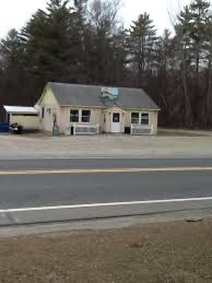
My first stop on Route 22 was about 60 miles up from Interstate 684. I pulled off on Route 344 to look around Taconic State Park in Copake Falls. I liked waterfalls, and I wanted to see one. I stopped in what appeared to be one of the only two commercial business in town (the other being Bash Bish Bicycles). It was a denim blue building with deep red trim around the windows that looked as if it had been built many, many upstate winters ago. The sign outside indicated that I was about to cross the threshold of the Depot Deli, unknowingly for the first of thousands of times.
I bought something, don’t know what, and I asked the girl about my age behind the counter how to get to “Cop-A-Key Falls.” She was very patient about correcting me, though I was embarrassed just the same. (It’s “Co-payke”). She also explained to me that there was no such thing, and what I was looking for was Bash Bish Falls, which was down that way about two miles.
So I walked out of the Depot Deli having made a complete ass of myself, but it all worked out, as the girl about my age is now my neighbor three mailboxes down North Mountain Road.


Bash Bish Falls is a glorious place, though in the summer you have to beware of the droves. One of the first things I bought for the upstate house was a framed print of a painting of Bash Bish called “Rocky Pool”, painted in 1856 by John Frederick Kensett, who was a Hudson River School guy. We also have a small painting of the falls by an artist friend of ours whom we met while she was painting a mural on the walls of the Depot Deli. So like a lot of people, my love for Bash Bish runs deep. It was early spring the first time we met, and I had it almost to myself. I don’t know how long I sat on a rock and stared that day, but I know it was longer than I can usually sit in one place. I’m sure I was getting all dramatic and philosophical sitting there by myself, maybe musing about where the path my life was on would ultimately end up, not realizing I was soaking in it.


I filed Copake Falls away that morning and pressed on with my absurd journey up 22. I went as far as Hoosick Falls, where I passed a sign telling me that Grandma Moses was buried nearby moments before I passed a bar in a two-story-porch house with a giant Grateful Dead “Steal Your Face” logo hanging on the railing of the upper porch. I thought I might start looking for work up this way. I hung a left and headed over the mountains and across the river at the Collar City Bridge in Troy, on the way to annoy some friends in Albany before going back down to the torture chamber.


When Trisha and I met, eleven excruciating years later, I soon found out that even though she was more of a beach and ocean gal, she loved the Upstate vibe as much as I did. I don’t know who brought up Copake Falls first, but it was like one of said, “you know Jesus? I know Jesus!” And she had an ace up her sleeve that I didn’t know about. She had booked a cabin in Taconic State Park months before and was planning on going up into the woods to celebrate her birthday by herself three weeks from then. My kinda gal. Then she had to figure out what to do with the new guy, so she said screw it, and she asked me to come along. I thought about it for a millionth of a second.
She drove. Even though riding shotgun brings out every OCD tendency in my sad little brain, she wanted to drive, and I didn’t want to blow this thing. It was after work on a Friday and we had to be at the park by 9 pm in order to check into the cabin. So of course, I had to mansplain that driving straight up Route 22 was more direct than taking Interstate 84 eight miles west to the Taconic Parkway, then heading 8 miles back east again. Plus 22 had lots of places to stop and eat, and I was hungry.
So since she didn’t want to blow the whole thing either, we drove up 22, stopped for dinner at Karen’s Diner in Patterson and arrived 15 minutes late at Taconic State Park, before cell phones, where we found Melissa Miller, who stuck around and waited for us because she thought we might have just gotten caught in traffic. Today Melissa is second-in-command at the park, and I will always be indebted to her for the fact that we didn’t have to sleep in a Dodge Daytona that night because I needed a cheeseburger.
The Dodge Daytona had as name. Her name was Chelsea. (And yes, apparently she had a gender as well). All our cars have had names because Trisha insists on naming cars, which I think is just adorable. Over the twenty years of renting cabins in the park, we drove up Route 22 (which she ultimately did admit was the faster route, if you didn’t stop at any diners) behind the wheels of Chelsea, Nameless (the Civic that I was driving when we met, which she named Nameless because it had no name, nor gender), a Honda Accord Sedan passed down from my parents that I named “Whitey” because I had to name it before she did, and Buster, the Honda Fit that ultimately replaced Chelsea, and is currently our son Jack’s learning to drive car.
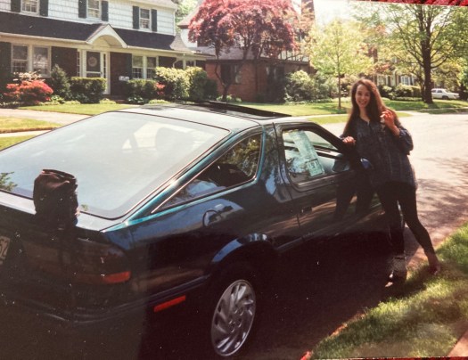
Now we have two Subarus, ‘cause we’re annoying: Trisha’s Crosstrek is a female named Jessie, and my Blue Outback is a guy named Lou. Lou the Blue Subaru. I’m sorry.
Lou replaced Dan the Van. Dan was a 2001 Ford Minivan that we bought when Jack was a baby because we convinced ourselves that we were going to have a second baby which we never did, and that we needed a vehicle big enough to carry two babies and all their belongings to Copake Falls. Dan was very comfortable, with captain’s chairs, sliding doors on each side and lots of other little bells and whistles, but he was nothing but trouble. Trisha would say that Dan was trying as hard as he could, and it wasn’t his fault he was a Ford.
Among the many things that inexplicably broke on Dan the Van was the windshield wiper motor. Not having a good go-to local mechanic at the time, I took him to a local Ford dealer, who replaced the windshield wiper motor, thanked me for my patronage and sent me on my way.
Fast-forward to our summer week in the cabin at Taconic State Park. Driving up 22, Dan develops a little cough, and is struggling on the hills. I’m a little concerned, but we make it OK. And this time around we’re bringing so much baby stuff for just one baby that Trisha is driving up solo in Chelsea.

And as would happen in some years when we only had a week in the cabin, it rained and it rained. And as it rained, Dan coughed more. I had been planning to take a Sunday Morning drive up a very steep mountain to eat blueberry pancakes with complete strangers at the annual Austerlitz Historical Society Blueberry Festival, because it’s there. But the forecast was running about 40% for drenching Columbia County thunderstorms, and I was afraid that Dan wouldn’t be able to handle it.
On that Saturday afternoon, I was shooting the breeze with the woman who was working the counter at the Depot Deli, one of Copake Falls’ oldest and most esteemed citizens. I told her about my dilemma, and she answered with one of my all-time favorite lines. Interpreting the crux of the problem as one of my not wanting to drive in a storm, this is what she said: “Well, John, that’s not the Country Way!”
I had to admit, it was not.
Of course, the Country Way starts with being able to diagnose and fix problems in your own damn car. That went without saying. And I sure as hell wasn’t going to get stuck in Austerlitz just for a plate of blueberry pancakes (though I had to weigh both sides). At the end of the very rainy week, I gave Trisha custody of the baby, said a prayer and headed down 22 driving a very sick minivan with comfy captain’s chairs, the Suburban Way.
That trip was the first time I looked at every stretch of road between Copake Falls and Brewster in terms of what it would be like to be stuck there for days and days. Believing that your vehicle will die at any moment really gives you a new perspective of place and distance. I have permanent psychic damage from this trip, but it was also the day when I sort of “took ownership” of that sixty-mile stretch of Route 22.
As for Dan, we miraculously made it back to Valley Stream, and the hidden blessing that followed the tragedy of missing the pancakes at the Austerlitz Blueberry Festival was meeting our man Pete, the new mechanic who had just opened a shop around the corner. Pete is the kind of guy who seems like he stays up at night worrying about your car. He has bailed Trisha and I out time and time again, the most spectacular example being last July when Lou the Blue Subaru blew his transmission (as Pete warned me he might) while carrying two kayaks, three people and all their stuff and one very confused Labrador on the Adirondack Northway enroute to Saranac Lake, leaving us stranded in Queensbury, New York, 217 miles from Valley Stream.
The good news was that the transmission was under warranty, and there was a Subaru dealer right nearby, the only one for hundreds of miles. The bad news is they were the only Subaru dealer for hundreds of miles, and they suggested that I might be eligible for Social Security before they’d get around to looking at my car. We rented a van (ironically) to get to Saranac Lake and then back to Long Island.
Enter Pete, the man who had years before determined that the mechanic at the Ford Dealer had not installed Dan the Van’s new windshield wiper motor correctly, and that the poor thing was coughing and sputtering from the water gushing into the engine every time in rained. This time, Pete called his brother who owns a fleet of tow trucks, who in turn sent a young fellow with a flatbed on a 435-mile round trip to rescue Lou the Blue Subaru and transport him to the Gregoris Subaru Service Department in Valley Stream, who fixed him in time for the next trip to Copake Falls in August.
And the people at Subaru Corporate were besides themselves with heartfelt regret about the whole business. Knowing full well that they sold me a CVT transmission that would break if I did everything with the car that they said I could (kayaks on the roof rack and all that) they not only paid for the new transmission, they reimbursed me for the rental car, and, inexplicably, sent me one of the those fancy Dyson cordless high-power vacuum cleaners, along with a little note of apology asking if we could still be friends.
So me and Lou, we’re all right now. Pete keeps us on the road, and we’re never more than a week or two away from “doing the drive” between Valley Stream to Copake Falls. The first half of the 117-mile trip is on parkways, the Cross Island over the Whitestone Bridge to the Hutchinson River Parkway to Interstate 684, where I always thank Dwight D. Eisenhower for knocking at least 45 minutes off the trip.
The second half of the trip starts on Route 22 in the Town of Brewster. There has been an ongoing and very entertaining debate over the years about where exactly Upstate New York starts. The official New York State version is that Upstate starts where commuter rail service to New York City ends, which on the Route 22 Corridor would be at the Metro North Station in Wassaic, about 30 miles south of Copake.
Trisha believes that Upstate starts at Exit 8 on 684, which is Hardscrabble Road in Croton Falls, just south of Interstate 84 and on the Westchester- Putnam County Line. Why? Because where else but in Upstate New York would you find a place called Hardscrabble Road in a place called Croton Falls? It’s a likely answer to: Quick! Make up a place that sounds like it’s in Upstate New York!
And the family from whom we bought our Copake Falls house owns and operates a tree farm that stretches along the valley in our front yard, and when the trees grow up, some of them go to the wholesale distribution center, the Hardscrabble Nursery on Hardscrabble Road in North Salem.
So it’s hard to argue with my beautiful wife on this point, as it is on most points because she’s always right. But I’m allowed to think what I want, and I think that Upstate New York starts just a little north on 22, at The Red Rooster Drive-In in the town of Brewster.


Back on Long Island, there’s a place in Massapequa Park called The All-American Burger. If I’m anywhere near it and I have the time, I have no choice but to stop for a Double Double (double burger, double cheese), fries and a milkshake. It is the best fast food on Long Island, quite possibly the world. Like All-American, and myself, the Red Rooster was first established in 1963, and all three of us have a classic, retro look. The Rooster was originally a single A-frame, with red and white stripes leading from a giant ice cream cone on the roof. A year or two ago they added an indoor dining room with a giant cheeseburger on the extension roof. A big happy white rooster with a mescaline smile, wearing a red and white checkered chef hat and matching apron, greets you warmly at the front doors (despite knowing you might get a chicken sandwich), and there is lots of outdoor seating alongside the kiddie playground and the miniature golf course, which features a smaller version of the same Rooster, along with Pinocchio, the requisite miniature golf windmill and an ersatz Porky Pig.
Rooster Burgers are pretty good. Damn tasty, actually. But they’re approximately 70% of the size of an All-American (single), and just not of the same caliber. Plus, you seem to be paying for the Red Rooster Experience as much as for the food, which depending on how hungry you are, is almost worth it. I’ve never seen anyone really unhappy there. You’ll go away fed and the chocolate shake will get you to Copake Falls.

Brewster is sort of the last suburb of New York City going up 22. But in a little section of the green space behind the Rooster, there’s an area set off with rocks with about 15 headstones called the Sherwood-Minor Burial Ground.
If the local burger joint has a 19th Century cemetery behind it, you may be in Upstate New York.
The six-year-old in my soul longs to putt golf balls through the windmill, but Lou and I press on. We’re a little beyond halfway to Copake Falls, Lou is purring along, my blood oxygen level is rising, and we’re about to check on the state of things along old 22.
There’s one more humongous shopping plaza in Brewster, set way off the road up on the top of a hill like a Greek city-state. Then things really start “Upstating.” The area around 22 for the next thirty miles is part of The Great Swamp, which is exactly what it says it is, filtering the water that flows down to the massive reservoirs that supply New York City’s drinking water. So traveling along through Putnam County and into Dutchess County, first we’re in the swamp, then we’re surrounded by more shopping plaza city-states near the village of Patterson, then we’re in the swamp again, then we’re in Pawling, then back to the swamp for a while, and then we’re in Dover.
And here’s something else: The stretch of New York State that straddles the Connecticut border is called The Oblong. When the border was first proposed between New York and Connecticut as twenty miles east of the Hudson River, the people in the towns of Greenwich and Stamford insisted that they had to remain part of Connecticut, whiny little bitches that they are. So Connecticut got a “panhandle” consisting of 761,440 acres. In return, the entire border of New York was moved 1.8 miles west, creating what was officially known as “The Equivalent Lands”, but which came to be known as The Oblong because of its shape.
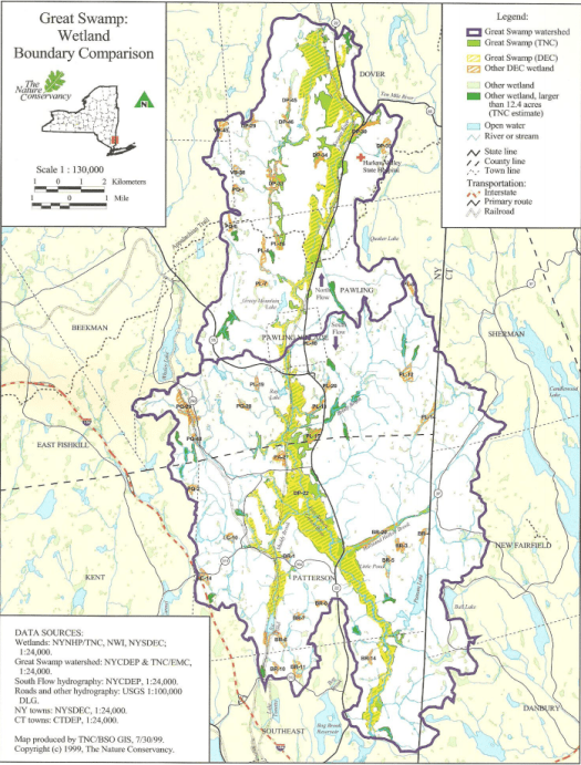
Lots of people drive my stretch of Route 22 without knowing that they’re passing through The Great Swamp, or that they’re traveling along the western edge of the Oblong. It doesn’t matter to them. They still get from here to there without knowing or caring about the nature or the history around them. Theoretically, we could all spend our short time on this Earth only learning what we think we need to know. None of the information I will share with you about the towns and landmarks that we’ll pass from here on is the least bit necessary to know to get from Putnam to Columbia County, and what I can tell you only scratches the surface of what there is to know. But to me, that’s exactly why it’s worth knowing.
Case in point. Unnecessary Fact #1: In fifty-eight miles, we will pass four Kingdom Halls, in Brewster, Pawling, Dover Plains and Millerton, plus a massive 670-acre headquarters of The Watchtower in Patterson.
This may not be enough to get your attention. But of course, the wonderful thing about living in the age of information is that you dig up completely useless information like this: The Watchtower in Patterson pours oodles of money in the surrounding community to make up for the fact that they have gobbled up a huge swatch of tax-exempt property. They have established the reputation of being very good neighbors. According to an article I came across in the Warwick Observer, the Patterson Town Supervisor sometimes asks the Watchtower folks to put the cows out in the pasture on Friday afternoons “for the tourists”.
So now you know two more things: The Patterson Town Supervisor is a marketing genius, and Jehovah’s Witnesses have cows.
You didn’t need to know this, of course, but see how much more fun it makes the trip?


It gets better: On a hill across from one of the Brewster City-States, you will find a brown building called the Ski Haus (spelled out in Old English-Style letters). They’ve been in business for 57 years, not only selling and renting skiing equipment but also selling kayaks, bicycles and Adirondack outdoor furniture. Apparently, they will even rent you a vacation house in Vermont.
Approximately 12 miles up the road, you will find The Shed Haus, which is actually a log-cabin style house surrounded by an acre of model backyard sheds on display. Hundreds of them, so it seems. Up until three years ago, the Shed Haus was the Shed Kingdom. This sets off layers of curiosity: Was the name “Shed Kingdom” a deliberate attempt to tap into the Jehovah’s Witness market? Were the people who took over and renamed the business “Shed Haus” deliberately trying to cash in on the success of the Ski Haus? Or was it a complete coincidence? Did it occur to the Shed Haus people that once you bought your skiing equipment, bicycles, kayaks and outdoor Adirondack furniture at the Ski Haus, you would need a Shed Haus to store it all in over the winter? And If the Ski Haus and the Shed Haus were both meant to conjure up the pre-colonial Dutch history in the region, why did they use the German word for house and not the Dutch word “huis”? I could understand that a business that wanted to get you excited about skiing would choose a name that sounded like something in the Alps, rather than in Brewster, but what is the connection between Germans and backyard sheds?
Sometimes the questions are more interesting than the answers. But I have to leave it at that, because we’re heading into Pawling.
Full disclosure: I have soft spot for Quakers. For one thing, I have a 96-year-old uncle in California, son of Irish-Catholics Immigrants, who has been a Quaker for 75 years. But while I’m drawn to Quaker ideas about pacifism and human rights, I could never work up that level of commitment, although I had started going to St. John’s in the Wilderness Episcopalian Church in Copake Falls before the Pandemic ruined everything. I hope to come back vaccinated someday. The Episcopalians are sort of the halfway point on the Religion-O-Meter between Catholics and Quakers, and that’s good enough for me.


Among the things I didn’t really need to know about Pawling, New York is that it was first settled by a Quaker who wanted to get the hell off Long Island. Nathan Birdsall was a surveyor from Oyster Bay who had once cut through the woods from Danbury, Connecticut to Pawling, assumedly to have a good story to tell. He later found out that the land in the Oblong was being sold by the State of New York and he sprang into action, gathering up Quakers from Long Island, Connecticut and Rhode Island to purchase several 500-acre plots of Oblong which became Quaker Hill.
The Quakers of Pawling outlawed slavery in their community in 1776, fifty years before the rest of New York State. Plus, they refused to do business with slaveholders, to the point where they used maple syrup instead of buying imported cane sugar. As conscientious objectors, they accepted George Washington and his Continental Army commandeering their meeting house during the Revolutionary War, but they stayed out of his business. (Acknowledgement to David Levine at HV Mag for this information).
The first time I tapped into this history was when I realized that I passed South Quaker Hill Road, Quaker Hill Road and North Quaker Hill Road in the space of four miles, so I looked on Google Maps to find that it goes way, way, way up, makes a big horseshoe, then comes way, way down. Then I looked at the Zillow real estate ads to find that there’s probably not a whole lot of living simply to please God in the $2 million-dollar houses for sale way up there. And there’s also an Old Quaker Hill Road, where you’ll find the original Meeting House and the Akin Free Library, a bizarre stone Georgian-style building with an ornate copper dome which houses a museum of Quaker artifacts, as well as a natural history museum in the basement, which according to the beautiful Atlas Obscura, features “oddities like meticulously scribed 19th-century shop ledgers, a first edition of The Hobbit, utopian Quaker pamphlets, a shrunken head, snake skins, hundreds of taxidermy local birds from 200 years ago, Native honed seashells, a giant moa egg, fetuses in jars, and spoon handles swallowed by a local mental patient.”
So it goes without saying that a visit to Quakerland in Pawling is on my bucket list, along with a visit to Daryl’s House.
Daryl’s House is just up the road past the Appalachian Trail. It used to be called The Town Crier. It’s now a bar/ restaurant/live-music venue owned by Daryl Hall of Hall and Oats. While I wasn’t a huge Hall and Oats fan, Trisha and I became big fans of his “Live from Daryl’s House” TV series, wherein he invites musicians to his actual house somewhere in Amenia or Millerton (or both) and he performs with them along with his kick ass “house band” (a phrase that takes on a whole new meaning in this case). Daryl Hall is truly a gifted singer, something you wouldn’t necessarily know from listening to bubble-gum pop songs like “Private Eyes” and “Maneater” (sorry, Daryl, but really) and he was able to let loose there in his big old restored colonial house, thus proving to skeptics like myself that he is a major talent, has great taste in music and was selling out to make money all those years, successfully so.
At least he got mega rich without hurting anybody, if you don’t count earworm damage. Most of the time as we were watching “Live From Daryl’s House”, we’d be asking each other over and over how the hell this guy can look and sound so good as he closes in on 75 years old. I guess that’s where the money comes in. Still.

During the height of the Covid-19 pandemic, Daryl’s House helped out the surrounding community by stocking and selling groceries and toilet paper. Anybody who loves the Oblong that much is all right with me. So I’d like to visit Daryl’s House to take in some live music one fine day. In the meantime, I always take a quick look in the parking lot as I pass by, just to see if he’s out there unloading his car.
One Kingdom Hall up the road from Daryl’s House, we pass the preposterously impressive campus of the Trinity Pawling School, massive buildings on a perfect hill one side of the road and a pristine athletic field on the other. Trinity-Pawling is an Episcopalian prep school for boys founded in 1907. Having spent 25 years as a public-school teacher and 13 years as a public-school student, I have no idea what’s it’s like to be up on that hill, never mind down on that field, so my mind immediately drifts to the only reference it has, which is the Robin Williams’ movie “Dead Poets Society”. Though I doubt if there’s a guy standing on a desk up there on that hill yelling “Carpe Diem!”, who knows? There might be. One thing I’m pretty sure of is that every one of the 6,000 alumni of Trinity-Pawling School was and is more comfortable wearing a suit and tie than I’ll ever be. Bless their hearts.


Our next stop on the journey north on Route 22 is Wingdale. There are people living happy, fulfilling lives in Wingdale. I have no proof of this, but I have anecdotal evidence. Not only is there a Pleasant Ridge Road (and how bad could that be?), there’s currently a house for sale with its own 10-acre lake created from a quarry from which came the marble used to build the U.S. Capitol. That house will run you $5 million. But if that’s out of your range, there’s a nice little 600 square-foot modular literally right around the corner you can snap up for $85,000. So it goes in the Hudson Valley.
For all the civic pride I’m sure residents have in their hearts for Wingdale, it just doesn’t have a whole lot of curb appeal as you travel along 22. And yet, it’s home to two internationally known businesses. This fact led to a fun little “when worlds collide” moment on my Facebook page last summer. It started when I posted a picture of the interior of the cabin I was staying in at Taconic State Park.
A woman I know through her extensive research about her native Valley Stream, who now lives just east of the Oblong in Kent, Ct, saw this picture and was convinced, “that table came from Hunt County Furniture in Wingdale!” Another friend, who I know from our time working in a supermarket 40 years ago, saw that comment and answered excitedly “Wingdale! Big W’s!”.
To which the woman responded, “What?”
I felt compelled to explain two things to Friend #1: First, The least expensive table at Hunt County Furniture will run you about $1500, and I don’t think that was in the state park budget, though it’s a very nice table, nonetheless. Maybe they made a deal for floor models.
Second, Big W’s is a barbecue restaurant in Wingdale that people travel from near and far to visit. Big W himself was an accomplished chef in New York City who moved upstate, bought himself a food truck, painted a smiling, slightly stoned pig face on it, rented a space on Route 22, installed a smoker and a woodpile under a car shelter and built himself a successful business. He later bought the deli next door to the truck and a made it into a small restaurant, with several smokers now housed in a prefab metal shed outside. He’s gotten rave reviews in The New York Times and Bon Appetit and no one ever has anything bad to say about him on Yelp or Trip Advisor. He was even featured on an episode of “Live From Daryl’s House,” wherein Daryl Hall takes the band down to Wingdale for the Big W’s experience.

Meanwhile, Hunt Country Furniture, handsome though it is, remains completely out of my league.
As you pass the Harlem Valley Metro North Station, things get very ugly very quickly. You are passing the site of what was the Harlem Valley Psychiatric Center, originally Harlem Valley State Hospital. You are face to face with the meanest looking buildings you ever saw, a whole bunch of them, deep-brick three-story Georgian thugs with barred windows, standing along the road with their arms crossed against their chests, sneering menacingly as they look down on you through the eyes of all the ghosts who live there.
It was an insane asylum. From 1924 until 1994. At its peak, it had over 5,000 patients and employed over 5,000 people on 600-plus acres of grounds. It was also a village unto itself with everything from farm production to sewage treatment. If it’s in your town – a bakery, a bowling alley, a swimming pool – it was in Harlem Valley. You can still see the small grandstand and the baseball field from the road, not quite as creepy as the hospital towers, but still it looks like a perfect setting for the weirdest fucking dream you’ll ever have.


Also back there somewhere is a golf course that was considered so good that a developer bought the land to build an entire community called Dover Knolls around it, but he never got it off the ground. He instead sold the lands to Olivet University, a religious school owned by a Korean evangelist named David Yang, who then got in big-time trouble for exposing workers to asbestos as they began to illegally start rehabbing the buildings and had to pay his way out of it with a couple of million dollars he had in the till. But the good news is that Olivet University will let you come in and play golf there if you pay them.
I’m sure some good things happened over the 60 years of Harlem Valley State Hospital. I’m sure some people who really needed compassion were able to find some. It’s especially nice that there was baseball. But all I can think of as I pass through Wingdale on Route 22 are all the people who were forced to go to places like this in the first half of the 20th Century. What a God-awful existence it must have been to be kept at Harlem Valley against your will, with the train going by all the time like at Folsom Prison. (Thank you Virginia Repka-Franco for that awesome bit of imagery and other information I picked up from an article at https://classicnewyorkhistory.com/harlem-valley-psychiatric-center-testament-changing-times/). All the cupcakes and fresh milk in the world wouldn’t have made a damn bit of difference.
The hospital was also at the “cutting-edge” of electro-shock therapy and lobotomy, so if you were one of those people who were sent there based on the 1920 definition of insanity, and you talked back, you likely ended up like Randle McMurphy. My mind does a mash up as I drive by, and I picture a young homosexual in New York City being declared insane by a judge, maybe a judge who graduated from Trinity-Pawling School and was ashamed at his secret feelings for his roommates. The judge commits the young man to Harlem Valley, where the electro-shock therapy accidently kills him. But no bother, they just bury him in the cemetery right there on the grounds, “The Gate of Heaven”, under a stone with a number instead of a name, to protect his family, who could just check the records to find the right gravestone, except that all the records were lost.
Or, they could have just left him the fuck alone, you know?

And of course, it’s not like the people who we trust to be in charge of things aren’t still making spectacularly stupid decisions. Case in point, about two miles up from Wingdale in the Town of Dover, we’ll drive past the 1,100-Megawatt Cricket Valley Energy Center, which recently went online despite New York State environmental laws that would shut it down in twenty years. While Hydraulic Fracking is banned in New York State, this monster was built to generate power from natural gas that is fracked in Pennsylvania and travels through the Iroquois Pipeline (what a disgusting thing to call it) across New York and into Connecticut.
The people who make money from Cricket Valley will tell you it’s clean energy, but it isn’t. It’s clean as compared to gnarly old coal-fired plants, but it still pollutes the air. The people of Dover who protested against it were also told that it would be a boon to their shitty economy.
This is from the Highlands Current:
In 2017, in exchange for not having to pay property taxes of $11.7 million annually, Cricket Valley Energy made a PILOT payment to Dover for $109,521. Under the same agreement, Cricket Valley Energy avoided $59 million in school taxes — its payment to Dover’s district was $552,559. Other taxes given up by the state and Dutchess County will total about $23 million.
Nice deal, eh? New York Governor Cuomo’s position was that it was already approved and in the works before all the new laws designed to reduce greenhouse gas emissions, so, oh well, deal with it. He does that sometimes. Besides, the energy produced by Crickey Valley will power a million homes, so they say. And all those mega-rich non-Quakers back in Pawling need to keep their central air cranking, and look, Dover, we even paved the road for you!
I don’t need clickbait to tell me that I’m one of the people who are moving up to the Hudson Valley “in droves”, and we droves need to charge our cell phones. I’m part of the problem in this respect, but if it’s any consolation, we generate most of our power back in Valley Stream from solar panels on the roof. Of course, up in the Town of Copake, the fight over a 500-acre (!) solar farm that is also being forced down local residents’ throats is being waged as we speak, and as usual, the locals are losing. This whole goddamn civilization thing is pretty much unsustainable at this point, so we might as well keep on burning gasoline and head north while we still can.
Our next stop is Dover Plains. I have met exactly one person from Dover Plains to my knowledge. She is the branch manager of a bank, and in our one encounter, she was professional, helpful, knowledgeable and exquisitely groomed. To comment on the people I see walking up and down Route 22 in Dover Plains as a means of making some sort of statement about a place of which I really know nothing would be catty. If you judged Valley Stream based on the people walking on Merrick Road, we wouldn’t come out looking so great. I try really, really hard not to look down on anyone, because it’s too easy. You can always find someone who you are “better” than, but it proves absolutely nothing. I wish I had been born with this wisdom instead of having to have learned it by catching myself being an asshole too many times when I was younger.
This brings us to Oniontown. Literally on the other side of the tracks in Dover Plains is a road is now identified as Seven Wells Brook Road. It used to be called Oniontown Road. If you look this up on Google Earth, there’s no street view, but from the satellite view, you will see a long road lined with trailers, many with garbage strewn around them. (You’ll also see footpaths that go off into the woods, which is probably the creepiest part of all of this to me). Historically, it was and is an area of extreme Appalachian-style poverty and everything that goes with extreme Appalachian-style poverty. Articles were written in the 1940’s about the noble savages who lived in Oniontown with no electricity and had to defend their honor constantly against the people in Dover Plains who looked down on them. The story was that they were not only insular but had been inbreeding for generations.
When the first generation of suburban droves started creeping further up the Hudson Valley and reached Interstate 84, they gave birth to intolerable children. Some of those intolerable children decided it would be fun to drive down Oniontown Road at night and pretend they were re-enacting the Blair Witch Project by shining flashlights on the trailers and property of the residents, then posting videos on You Tube. Then these young, affluent cretins started getting their windshields and heads bashed in with bricks, which to me and many others was a totally reasonable response on the part of the people on Oniontown Road. Things spiraled out of control, of course, and it was great fun for all the You Tubers when the Dover Police Chief warned them to “stay out of Oniontown.” It was shortly thereafter that they changed the name of the road.
A writer named Aaron Lake Smith wrote a great piece of investigative journalism for Vice Magazine where he was able to get some of the Oniontown Road residents to open up about their experiences, not only with the misguided thrill-seekers driving up from the 84 corridor but with local Dover Plains people, especially their experiences in having to fight their way through school. It seems that while they were once ostracized for being inbred, now they’re targeted for being mixed-bred.
Ugh.
This area of Dutchess County has always been relatively poor, outside of the dude with the marble quarry lake and the post-modern Quakers. And maybe finding somebody to look down on becomes a more attractive strategy the less you have. But the suburban droves and the citiots can’t be bothered learning anything about the places they’re invading, or the people who live honest lives there, because it isn’t something they have to know to get where they’re going. And let me tell you, there’s a little war brewing up across the entire Hudson Valley between the locals and the citiots, and more bricks, at least figurative ones, will probably be thrown before it’s over.
But we need to shake all this ugliness off, don’t we? It’s been nothing but bad news since we left Big W’s Roadhouse. How about I show you some horses?
Just south of Dover Plains, we’ll pass by Lucky Orphans Horse Rescue, established in 2008 to provide shelter and rehabilitation to abused and neglected horses. According to their mission statement, They are also “committed to working side by side with the horses we rescue to help change the lives of people with a diverse range of struggles such as those suffering with addictions, depression, grief and loss, trauma, at-risk youth and improving relationships in families and groups.”
And since I told you about the Lucky Horses, I have to give props to another local organization. In Amenia, you won’t see the horses from the road (not even if you’re a tourist) but you’ll see a sign at the top of a hill for an organization called Godspeed, “a multi species Animal Welfare Service Rescue that provides food, medical, placement, and solutions to animal welfare problems, free of charge, to large domestic animals, farm animals, companion animals and wildlife.” They also facilitate cat spaying and neutering and support local pet food panties.
What wonderful things these people are doing. And this is one of the things about Upstate New York that I find particularly fascinating: A couple of acres of nasty scary ugly in one place is almost always juxtaposed by a couple of acres of unique charming beautiful in another place right nearby.


A long time ago, Trisha and I drove down Sinpatch Road in Wassaic to look at a house we saw on Zillow. I really have no idea what the hell we were thinking at the time, but it had something to do with a Metro North train to the city being right nearby. Of course, the train takes about two and a half hours to get to Grand Central Station, and I guess we hadn’t fully thought that one through. The neighborhood was “hardscrabble” to say the least. We’re pretty sure there was a guy living in a metal shed in the backyard of the house in question. A few people in the area had junk collections in their front yards which they may or may not have been proud to display.
And yet, right down the road is a place called The World Peace Sanctuary, which started with a man in Japan named Masahisa Goi who received the message “May Peace Prevail on Earth” after meditating on the devastation wrought on his country after WWII. He became known as a sensei, gained followers and began a movement to put up four-sided “Peace Poles” all over the world, with that message written in different languages on each side of the pole. This led to “Peace Pals International”, which encourages schools and youth groups to create peace poles. Plus, at the Sanctuary itself, they have a peace pole representing every nation in the world (so they say), where people gather to mediate once a month. And apparently, if you want to, you can ask for a mallet to ring the “Peace Gong” at the front entrance and send your energy out into the world.
Why, you ask, is a place that began as a reaction to the bombing of Hiroshima and Nagasaki in the middle of nowhere around the corner from Wassiac’s Tobacco Road?
I have two answers for that: 1) I don’t know, and 2) Why not?
Welcome to the mysteries of the Hudson Valley.
We’ve reached the village of Amenia. It’s a nice little place, isn’t it?. The Four Brothers Pizza Restaurant, a chain that actually outnumbers the Kingdom Halls on the Route 22 corridor, opened a little drive-in movie theater a couple of years ago. It’s the kind of thing that lets a little town say to the rest of the world, “we have fun here.” Some beautiful old Hudson Valley architecture surrounds us as we roll through town. Of course, like all of this side of Duchess County, there are also buildings that are in such poor shape that it defies the laws of gravity that they’re still standing. It was while passing by one of those buildings in Amenia that I learned how to say “Please Curb Your Dog” in Spanish (“Por favor frener a tu perro”) from a handwritten bilingual sign taped to a utility pole. It occurred to me that this sign shared the same concept as the Peace Poles. May curbing your dog prevail on Earth.
Nothing much happens between Amenia and Millerton, but at this point, 22 emerges from a series of dark hollows through the Great Swamp and steps out into lush rolling hills and farmland. This is where we’ll find McEnroe’s Organic Farm Market. I’ll be devoting one of the later chapters in this book to all the wonderful places where you can get a fresh turkey sandwich within twenty minutes of Copake Falls, and you’ll learn a little more about McEnroe’s if you can stick around that long. For now, I have to tell you about a little bone I had to pick with them. A figurative one, not a turkey one.
For years and years, McEnroes’s enticed passers-by with a series of small signs on the side of the road with their logo (“McEnroe’s Farm Market” surrounding three happy little tomatoes) with a small rectangular sign titled at a 20-degree angle attached to each of the bigger signs announcing, in big block letters, “LUNCH!”. The last sign, traveling in either direction, had another sign under it that said, “OOPS! YOU MISSED THE FARM!”
On almost every day of my 25-year teaching career, my lunch was a peanut butter and jelly sandwich that I ate in ten minutes. I had completely forgotten that lunch could be a celebration. Why just have lunch if you can have LUNCH!? I was intrigued.
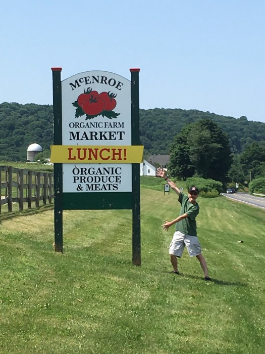
Seeing as it was only twenty minutes from Copake Falls, I finally made it down to McEnroe’s, and LUNCH! did not disappoint. But the very next summer whoever is in charge of those signs disappointed me terribly. In horror, I saw that they had replaced all the signs that said “LUNCH!” with signs that say “EATERY!”
Eatery?
Ok, they sell a lot of stuff there. Anything edible that can be grown organically as a matter of fact. So yeah, it is more than lunch.
But EATERY?
You know what this is all about, right? It’s the citiots again. It’s the people who sneer at The Red Rooster and Big W’s Roadhouse Bar-B-Q, or think they’re all hip and in the know because, “Oh, look! I read about that place the Times! How quaint!” The ones who drive their Zip Cars from Manhattan to their ridiculous mansions up in Hillsdale to host fancy dinner parties at long picnic tables where the guys all wear pink polos and khakis and the women wear white dresses and floppy hats. The ones who drive into Hudson for art gallery openings on Saturday afternoon, maybe a tour of the local wineries on Sunday before they head back to the Upper West Side. The kind of people who would drive right by a sign that says “LUNCH!”, but slow down and say, “Honey? Let’s stop at this eatery!”
As one of the droves, I have to suffer for their sins. For one thing, I have to be extra nice and polite to everybody because I have a Long Island accent you could cut with a chain saw. In every encounter I have with a Columbia County native, I have to somehow establish implicitly (mostly through the simple rules of politeness) that I’m not one of them. I like LUNCH! Just like you. And I don’t need to go to no damn eatery to get it.
It’s not enough to keep me away from McEnroe’s. They have everything there. I have no choice but to forgive them for this assault on my sensibilities. I just wish they had left the signs alone.
Then again, up the next hill, at the exact 100-mile mark from my driveway in Valley Stream, there’s a green little restaurant called the Round III (I’m sure there’s a story there) that has been trying to entice me off the road for twenty years with messages like “Breakfast All Day! Apple Cinnamon Pancakes!” This summer, they’re pushing turkey cranberry melt sandwiches on that sign, so maybe I’ll have to step up and choose sides in this culture war over LUNCH!
Moving on, the farms get farmier and the rolling hills get rollier as we approach the Village of Millerton, where the area approaching the village along 22 is known as Irondale. This is one of the many places where iron ore was mined and cooked in giant furnaces in the 19thCentury. The hamlet of Copake Falls started out as Copake Iron Works. That whole story will get its own chapter later on, but in the meantime, I would just like to point out that “Irondale” would be a really cool thing to be able to say when someone asks you where you’re from. They’d sure think twice about messing with somebody who comes from a place called Irondale.
But I digress.
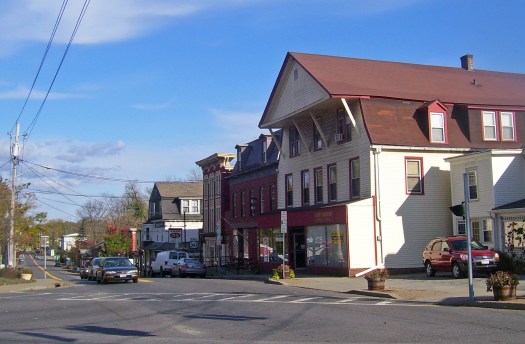
We are at the three-way intersection of 22 and 44 in in the village of Millerton. We’re at the top of the Oblong, right over the border from Lakeview and Salisbury Connecticut, where a lot of the “eatery” crowd can be found. A look to your right and you’ll see stores both hipster and practical lining the street going up to the top of a small hill. Downtown Millerton on 44 seems to have struck a nice balance between eateries and places to eat lunch, between the historic Hudson Valley and The Valley of The Droves.
If you happen to be waiting at a red light at this three-way intersection in warmer months and you look to your left, where the road isn’t, you will see a house on a hill surrounded by stunning perennial flowers. On the day after Tropical Storm Isaias, I “did the drive” from Valley Stream to Copake Falls to see if there was any damage to the house. (I could have bugged a neighbor who did some caretaking for us over the winter, but I figured if there were damage, she’d have her own to clean up, and besides, that’s not the Country Way). At the Millerton light, I noticed a woman outside the house, pulling branches out of the garden. There was no one else at the light and she looked at me and I looked at her, and I called up the hill to her, “I’ve been admiring your garden for twenty years!” And she smiled and thanked me.


On the way back that afternoon, I looked up again to see if she was there, since we’re friends now, but I didn’t see her. But that’s when I noticed the Peace Pole in the corner of her yard.
Kismet, man.
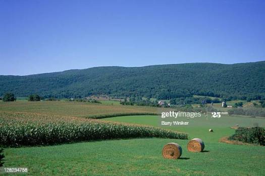
We’re in the homestretch now. A small hollow leads out of Millerton and the road begins to elevate. Out the window on your side of your car, you can see the Taconic Berkshire range start to rise across the farm fields. Up and over a steep hill and we pass the Willowbrook Farm (watching out for crossing geese). As we pass a sign welcoming us to Columbia County, we go up up up and the mountains have stepped onto the stage like the main act that the Great Swamp was warming up for. Alander, Frissell, Brace, Haystack, Bash Bish, Washburn and their somewhat shorter friends (including Sunset Rock Mountain in our backyard) forming a ridge starting from the corner where New York, Connecticut and Massachusetts converge and running straight up the New York / Massachusetts border to Vermont. When you’re up this way, the mountains are always with you, everywhere you go, friendly old giants sitting on their front porches, keeping an eye on the neighborhood, taking in the valley views while the clouds rolling by paint them a hundred shades of green. We are 110 miles away from Valley Stream, Long Island, and we’re on a different planet. It’s a view that never fails to take my breath away.
And you’ll notice that I’ve slowed way down so you can really enjoy this majestic mountain view, but it’s really because the stretch of 22 in Town of Ancram is one big speed trap.
We’re passing the AmeriStore Gas Station at the corner of 22 and County Route 3, and up ahead is the former Hill-Over-Holstiens Farm where I used to buy fresh milk in bottles in their little store. Sometimes nobody was in the store, and you could just help yourself to the milk and leave your money in the cash box. A lot of places still operate like that, but every year there’s one more story about some citiot who drove away from a farm with the money box. This particular farm, 391 acres, is for sale right now for $6.2 million. As with all the farmland for sale in the area, you can only hope that it is not carved up into more space for the droves.
Fortunately, the Town of Copake has a list of zoning regulations as long as the Appalachian Trail regarding what can and cannot be done in the “Scenic Corridor Overlay Zone.” on Route 22. And it’s remained a beautiful place, pretty much as I first found it in 1988, despite the local unrepentant asshole who has been polluting it for twenty years.
You know you’re coming into Copake when you see two things: Tom Hill, a little 892-foot high mini-me mountain that seems to pop right out of the road directly in front of you, and the billboard for Dad’s “50’s-Style” Copake Diner, which gets its own chapter later on. If you want to go to Dad’s, you jump off at Route 7A, where the little hamlet of Copake lies waiting. I’ll show you around a bit before this book is done. I may always be an outsider, but at least I’ve done my homework, and I defy any of the 3,500 residents of Copake Town to call this Lawn Guylander a citiot, even if I can’t fix my own car.
Right across from Dad’s billboard, back on 22, you’ll see a long red building set back from the road behind a very expensive looking stone wall. You’ll see that the sign on the building says, “Farm Market”. If you look closer, behind huge stacks of firewood, you’ll see that the Farm Market building is empty. This is because it’s a complete sham. If you look closer still, you’ll see bulldozers and payloaders, and a sickly-looking cornfield in the distance.
The guy who owns the 300 acres behind the Phony Farm Market has been dumping construction waste on his property for at least twenty years. His apparent strategy was to throw expensive lawyers at the poor little Town of Copake every time they tried to nail him for fragrantly breaking the law, and to a certain extent, it worked. He even built the Phony Farm Market without obtaining permits, along with building a steel bridge across the environmentally sensitive Noster Kill, which runs through the property.
Every time Copake hauled him into court, he’d pay his way out it, and with a big old jolly fuck you, he’d continue to dump polluted soil on his “farm”. Many good people in Copake spent many hours of their lives fighting this truly unrepentant asshole. All that effort spent on the disorder created by one guy in two square miles, but that’s just how they roll, isn’t it?
To their credit, New York State DOC finally stepped in and hauled the gentleman’s wiseguy ass into jail, where he has spent much of the last few years, but apparently the polluted soil remains, and it’s a safe bet that the dumping is still going on.
But the thing that amazes me most of all about this story is that the guy went to the trouble of building the Illegal Phony Farm Market building, seemingly to make the property look nicer from the road. It’s the only thing that makes sense, as everybody knows what he was really up to. On some level I think he was, like me, afraid of being considered a citiot by the locals.
Go figure.
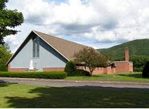
Right before we take the Route 344 right turn into the hamlet of Copake Falls, we pass Our Lady of Hope Catholic Church. When Trisha and I first began our alternative existence up here, it was called St. Bridget’s. In 2009, St. Bridget’s merged with St. John Vianney in Churchtown to create Our Lady of Hope parish. In turn, St. John Vianney had previously merged with Holy Cross in Taghkanic and Sacred Heart in Philmont in 2005. So as you can see, the Catholics are going to have got to step up their game in the Hudson Valley, as they’re plainly getting their asses kicked by Jehovah’s Witnesses.
They’ve just about lost me to the Episcopalians at this point, and if you stick around, there’s a chapter coming up about a great little church in Copake Falls that Welcomes You.
In the meantime, with a winding climb up North Mountain Road, our 117-mile journey is complete. At Trisha’s Mountain, we’re going to bring the stuff in from the car, make a phone call and drive back down to Church Street Deli and Pizza across from Dad’s. We’re going to bring back some genuine Long Island-Style Pizza (not quite on the level Ancona’s in Valley Stream, but close) and later we’re going to drag some camp chairs down the driveway to watch The Show. You’ll see.
Speaking of The Show, it’s time for the next chapter, but I’ll wrap this one up with something I picked up from a Catholic priest at St. Bridget’s many, many years ago. (When they’re good, they’re very, very good). It’s one of my personal mantras, practical advice for any occasion, whether you’re discovering a new town or you’re driving through towns you’ve driven though fifty times, whether you’re stopping for a good old-fashioned LUNCH!, tending your garden, planting your Peace Pole or just sitting and watching the light dance with the mountains.
When they would get to the readings in the mass, the part where they tell the little stories, this is what the priest said:
“Let us be attentive.”
I’d have to go back and ask my old friend from the Depot Deli to find out for certain, but I’m pretty sure that, along with not letting the rain stop you and fixing things yourself, being aware of the nature and the history that surrounds you is part of the Country Way.
Copyright 2020 by John Duffy
All Rights Reserved
